Real World Math
  • Home
  • Lesson Downloads
    • Concept Lessons
    • Measurement Lessons
    • Project Based Learning
    • Exploratory Lessons
    • Space Lessons
  • Videos
  • Tutorials
    • Google Earth Tutorials
    • Xtranormal Tutorials
    • HTML Layout Tutorials >
      • Introduction
      • The Basics
      • Layout Templates >
        • Cover page
        • Blogger HTML Formatting
        • Paragraphs w Image
        • Image w. bullets
        • Video
        • Split text & image
        • Complex table
      • More tips
  • Teachers
    • Lessons >
      • Concept Lesson Outlines >
        • Around the World...
        • Estimation
        • Exchange Rate
        • Line Graphs
        • Oil Spill Estimates
        • Planes of Greenland
        • Polyhedrons
        • Scientific Notation 1
        • Scientific Notation 2
        • Tessellations
        • Time Zone Problems
        • Volume of Solids
      • Measurement Lesson Outlines >
        • Intercept Theorem
        • Complex Area
        • Crop Circles
        • Estimating Distance
        • Fractal Coastline
        • Tsunami Warning
      • PBL Lesson Outlines >
        • Spreadsheet App
        • Community Building
        • Iditarod Challenge
        • SAR Project
        • SketchUp
        • Typhoon Project
        • U-Boat Hunt
        • Water Problems
      • Exploratory Lesson Outlines >
        • Crop Circles 2
        • Four Color Map
        • Line Patterns
        • Mazes & Labyrinths
        • Networks
        • Pyramid in the Desert
        • The Flat Earth
        • Whale Watch
      • Space Lesson Outlines >
        • Lunar Fieldtrip
        • Lunar Sports
        • Rockets
    • Blog
    • About the site
    • RWM Video Overview
  • Contact
Kmz Download
Teacher Downloads

Student Worksheet
Answer Key

Concepts Used
Measurement
Integers
Data & Statistics

Grade level
Grades 5-8

Subject Areas
Math
Social Science
Health

NCTM Standards
Measurement
Representation
Problem Solving
Communication
Connections
Technology

NETS*S
1a, 1c, 1d, 3b, 3c,
3d, 4a, 4b, 4c, 4d,
5d, 6a, 6b

Google Earth screen grab
Click to view

Water Problems


Objectives
  • Collect and record terrain data
  • Express changes in elevation as integers
  • Analyze data on a chart and make decisions based on that data
  • Work cooperatively with a partner
  • Gain an understanding of a real world problem

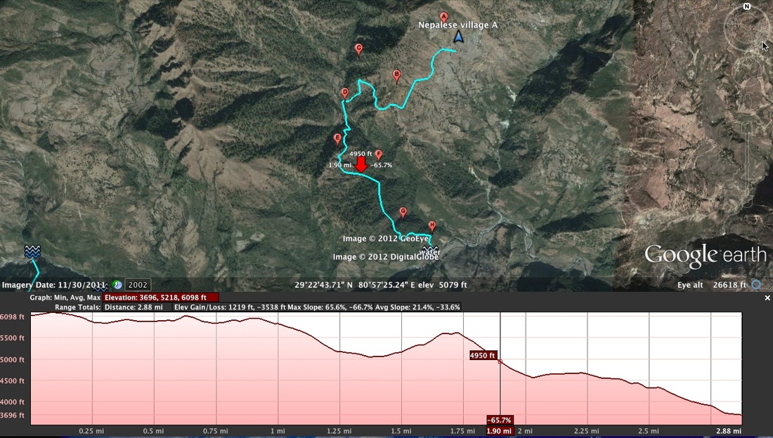
Lesson Description

This activity utilizes a relatively new option in Google Earth while examining a real world dilemma.  More than a billion people on the planet are faced with an inadequate supply of water.  For many, this means they must travel miles every day to reach their water source.  This task of hauling water typically falls upon women and children.  For this lesson, the students are given several paths to water and asked to analyze the changes in elevation. This is accomplished using the elevation profile.  This new feature allows one to examine the elevation of a path on the Earth’s surface in a pop-up graphic.

The elevation profile can be selected in the path’s menu.  It includes a line graph depicting the changes of elevation, and data regarding the elevations, distance, and slope.  As one moves the cursor across the graph, a red arrow appears in Google Earth’s main window indicating the corresponding location.  In this way, the elevation of a path can be inspected for a specific location or across the entire span of the path.

Two countries are highlighted in the lesson: Burkina Faso and Nepal.  For each location, students are presented with a path from a village to a water source.  The students inspect the location and then collect data of the path using the elevation profile graph.  The problems then develop into that of an analytic nature.  Would you rather haul water over a long distance or across a steep terrain?  What would the best path to water be?

I’ve placed this activity with the Project-Based Learning group of lessons for several reasons.  First, I think it would work best to have pairs of students working on these questions.  There isn’t always one true answer, so the sharing of different viewpoints should be encouraged.  Second, I sincerely hope that teachers use this lesson as part of a large theme unit, such as conservation of natural resources or multicultural education.  I’ve included some links below to related material, including a comprehensive unit on Nepal’s culture and water situation by Educate the Children and Cornell University.  Work with your fellow teachers and design a unit that best suits your students.  Finally, although the lesson itself can be accomplished in one sitting, it might best be split into three stages so that the class can discuss key elements.  I’ve included some points of discussion with the Teacher’s Water Problems worksheet.


Suggested Links:

  • To Sustain Life: Water and Development in Nepal by Educate the Children and Cornell University’s South Asia Program
  • Water calculator from About.com
  • Water in Africa, part of the Peace Corp’s World Wise Schools curriculum
  • The World’s Water - Information on the World’s Freshwater Resources
Creative Commons License
This work is licensed under a Creative Commons Attribution-NonCommercial-ShareAlike 3.0 Unported License.